|
The Villa is located a few
south of Playa Dominical. There are two routes from San Jose to Dominical by car:
The easiest and fastest driving route to Dominical is via the San Jose Caldera toll road then along the costal road.
An alternate route via Inter-American Highway south to San Isidro de El General and then west to the Pacific Coast.
 The drive is several hours long, normally 3-4 depending on the route taken. Both routes are scenic and the roads are paved and in good condition. However, we do strongly recommend that if you choose to drive the mountain route (San Isidro de El General), you begin before 10 AM, when there is plenty of light and little fog in the mountains. The drive is several hours long, normally 3-4 depending on the route taken. Both routes are scenic and the roads are paved and in good condition. However, we do strongly recommend that if you choose to drive the mountain route (San Isidro de El General), you begin before 10 AM, when there is plenty of light and little fog in the mountains.
Alternatively, if you wish to avoid a long drive you may consider a Sansa or Nature Air flight from San Jose to either Quepos or Palmar Sur, arranging in advance to be met by a car rental agency at the Airport. The drive from either airport to the Villa is less than an hour. The flight is about 30 minutes.
DRIVING THE COAST ROAD ROUTE.
From Downtown San Jose:
If your trip begins in San Jose, ask your car rental agency or hotel for directions to Route 27, the Autopista del Sol also known locally as "the Caldera". Once on the Autopista del Sol, proceed to the first toll plaza after you have passed the exits for the town of Orotina. Then skip down to the seventh bullet point below and continue following the directions
From the airport:
- Most of the airport car rental agencies have offices across Route 1 (Autopista General Cañas) from the airport. When you exit the rental agency, return to Route 1 by driving on the access road between the Holiday Inn (on the left) and the Denny’s restaurant/Fiesta Casino (on the right), then turning right. You must immediately cross into the left lane and turn left onto the exit lane to Route 1. Merge onto Route 1 and continue past the airport terminal turnoff.
- Immediately after passing the turnoff into the airport, you will be in the left lane (“San Ramon”); stay in that lane rather than the right lane, which exits to Alajuela and check your odometer reading.
- Continue on Route 1, about 7 kilometers, and look for a pair of bridges spanning the highway (one bridge is concrete, the other is a steel truss bridge) and turn right off the highway onto a ramp that circles to the right and puts you on the truss bridge. Cross the highway and continue straight for about 3 kilometers.
- The road is limited access: there is only one interchange before you get to the Autopista Del Sol (Rte. 27), a limited access toll road that you will follow through the coastal mountains.
- Nearing Route 27, you will cross a railroad track and immediately come to a traffic circle. Follow the traffic circle and turn right onto the Autopista (the sign says “Orotina” or “Caldera”.
- Stay on the Autopista (Route 27) toward “Atenas” and “Orotina.” You will pass through three toll plazas (the tolls can be paid in colones or dollars).
- Bullet #7 - Immediately after the third toll plaza, you will see an exit on the right for “Tarcoles” and “Jaco.” Follow the exit ramp to the right as it passes under the toll road in cloverleaf interchange fashion and deposits you onto a highway (Route 34, the Costanera Sur) toward Jaco and Tarcoles.
- IMPORTANT: Be aware on the toll road. There are great scenic panoramas on the route, but stay focused on the road and especially the other drivers. Ticos are not accustomed to roads like this and you should remain alert and aware because bizarre driving moves, taken at high speeds, may well be part of the trip.
- Orotina – Quepos. The toll road is now behind as you head towards Jaco and Quepos to approach the coast. Drive carefully across a long, narrow bridge over the Rio Tarcoles, because it is often filled with touristas trying to catch a glimpse of the American crocodiles that inhabit
 the river and the red macaws that fly over the area. the river and the red macaws that fly over the area.
- If you feel the need for gourmet-level groceries, stop at the AM Automercado located in the shopping center at Los Suenos, just north of Jaco (about ½ hour from the Tarcoles bridge). The parking lot at the shopping center is guarded, but lock your doors and put valuables in the trunk where they cannot be seen – standard practice in the Jaco area.
- Continue past Jaco, keeping the Pacific coast to your right as you travel down the coast, through towns like Playa Hermosa, then Parrita, toward the town of Quepos.
- Quepos-Dominical. Just before Quepos, you will come to a “Y” in the road. If you bear right the road signs direct you to “Quepos” and “Manuel Antonio” but you should bear left onto the road that bypasses the town, following signs to “Dominical” and “Airport.”
- South of the airport, the road is wide and fast, but caution should be used driving the route, because it is relatively new and nearby farmers are not yet used to having a modern highway here and sometimes allow their livestock to roam freely around – and across – the roadway.
- Just before reaching Dominical there is a gas station on the right; you may want to fill your tank, as gas stations are not too prevalent on the highway as you probably noticed on the way
 from the toll road. Two kilometers past the gas station is the intersection of the Costanera with the road to San Isidro de El General. Cross the concrete bridge over the Baru River, pass the entrance to Dominical and continue south on the Costanera. from the toll road. Two kilometers past the gas station is the intersection of the Costanera with the road to San Isidro de El General. Cross the concrete bridge over the Baru River, pass the entrance to Dominical and continue south on the Costanera.
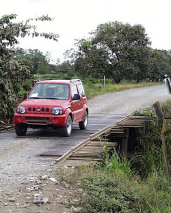
- The San Martin Road. Beginning at the bridge across the Baru River, the Costanera is marked with distance signs. After kilometer marker 151, the road curves gradually to the right. Midway through the curve, the roadway begins a gentle rise. At the top of the rise, where the curve ends, you will see a bus shelter labeled “San Martin Sur” on the left. Turn left a the far end of the bus shelter and proceed up the San Martin Road for the final 2 kilometers to the Villa. At this point you need to engage your 4-wheel drive.
- After climbing approximately 2 kilometers, the San Martin Road reaches a crossroads. Follow the “Villa Escaleras” sign and turn right at the crossroads and continue about ½ kilometer to the Villa (driveway intersects from right). The driveway 100 feet after the Villa Escaleras entrance leads to the Casa. Pick up keys to the Villa there. (The driveway is steep and you may find it easier to park at the Villa and walk over.)
DRIVING THE INTER-AMERICAN HIGHWAY ROUTE.
The route is approximately 170 kilometers and takes about 4 hours. It is often rainy and foggy in the early afternoons, so it is best to start your journey from San Jose in the morning.
San Jose - Cartago
Travel south from San Jose, following the "Route 2" signs toward Cartago. After the toll station, follow the sign "Tres Rios-Cartago-Panama" through a multiple highway intersection. As you near the town of Cartago, watch for a modern 24-hour Shell gas station on your right. Keep to the right after you pass the gas station. (If you bear left, you will end up in the city of Cartago and have to backtrack.)
Cartago - San Isidro
You will then pass through pastureland dotted with pinewoods and the Centro Industrial-Cartago. After a few miles you begin to climb into the mountains. The climate, flora and fauna are diverse and the views stunning. The highway climbs to an altitude of nearly 12,000 feet, before descending into the town of San Isidro de El General (about 3 hours). As you enter San Isidro de El General, watch for the sign for the road to Dominical (A McDonald’s fast food restaurant is located on the corner).
After passing through San Isidro, the street becomes a beautiful rural road that winds up through the coastal mountain range and then down toward the Pacific Ocean and Dominical (about 1 hour).
The San Isidro road ends at the Costañera Sur or coast highway. At that intersection, turn left (south), onto the coast highway. You will immediately cross a concrete bridge over the Rio Baru, continuing past the side road to Dominical (about .4 kilometers on the right), then the Plaza Pacifica shopping center (on the left).
The Costanera is marked with distance signs every kilometer (some may be missing).
The San Martin Road. Beginning at the bridge across the Baru River, the Costanera is marked with distance signs. After kilometer marker 151, the road curves gradually to the right. Midway through the curve, the roadway begins a gentle rise. At the top of the rise, where the curve ends, you will see a bus shelter labeled “San Martin Sur” on the left. Turn left a the far end of the bus shelter and proceed up the San Martin Road for the final 2 kilometers to the Villa. At this point you need to engage your 4-wheel drive.
After climbing approximately 2 kilometers, the San Martin Road reaches a crossroads. Follow the “Villa Escaleras” sign and turn right at the crossroads and continue about ½ kilometer to the Villa (driveway intersects from right).
The driveway 100 feet after the Villa Escaleras entrance leads to the Casa. Pick up keys to the Villa there. (The driveway is steep and you may find it easier to park at the Villa and walk over.)
We have provided some helpful hints for those of you who chose to drive. Please click here to read or print them.
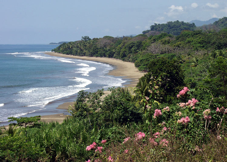
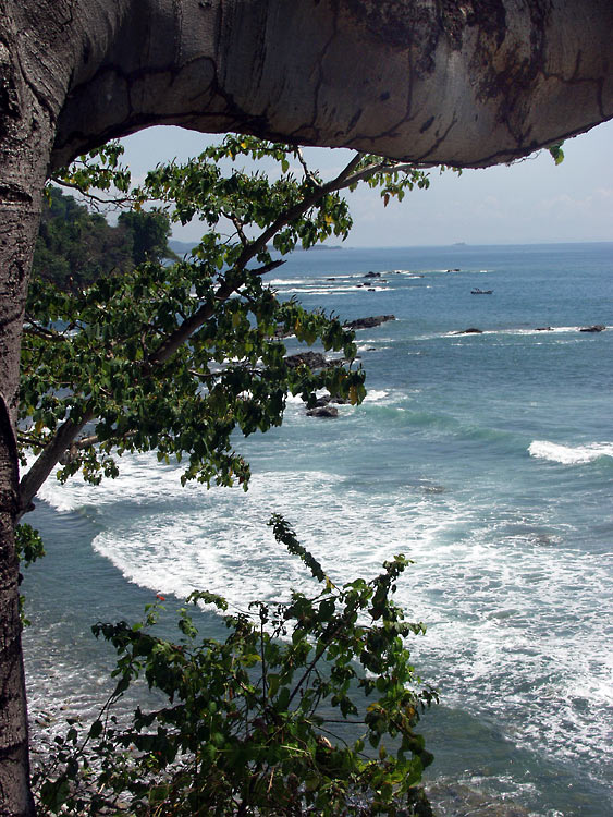
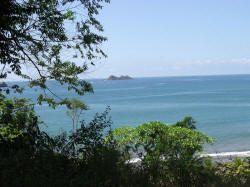
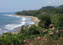
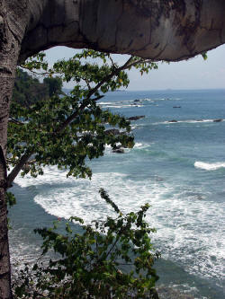
The photos on this page were all taken in and around Dominical, Costa Rica by Tim Lytle and are copyrighted. Used by permission. All rights reserved © 2003-2012 Tim Lytle |
|